The trail we picked for Friday was the one that would take us to the summit of Mt Cammerer where a fire lookout is located. When I did my research for our week-end, I simply typed "best hikes in the smokies" then made my choice according to our campsite. As I said it worked out perfectly since all we had to do was cross the road to be at the trailhead. 2470 feet of elevation gain, 10.5 miles round trip, we left at 10am making use of the temperatures that are at last cooling off.
The first 2.5 miles were the hardest, switchbacks goins up, and up and up like they would never end. We first crossed a creek before getting into the depth of a beautiful forest. At last we could see the saddle/gap, a few more effort and we were there. On our way we heard weird birds whose sound reminded us of horse hoofs hitting the pavement. Then the trail was easier, following the mountain right under the crest and on the A.T. (Appalachian Trail).
At the saddle a small field of wildflowers was attracting numerous species of butterflies, a real pleasure to the eyes.
Around a corner of the trail the view opens up at last and we can look at the crest that we're about to follow.
Along the trail we saw many wildflowers including this odd "double flower". Yes it seems that flowers too do "skyscrapers" (the top flowers grows in the middle of the bottom one).
An other saddle, we take a different trail to Mt Cammerer and leave the A.T. behind us.
The last section of the trail is different from the rest of the hike: we leave the forest for a much shorter flora, bushes, rhododendrons of small sizes, no doubt, we are on the crests.
There also were pretty lichens on the sides of the trail.
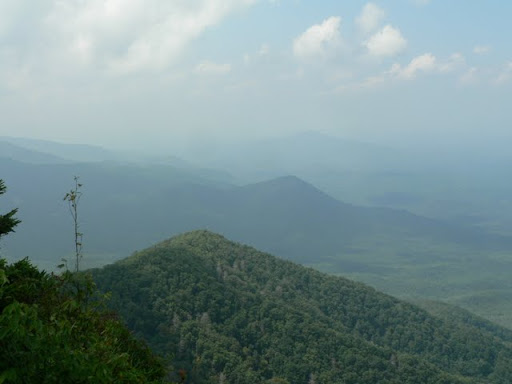
 Enfin nous voila au sommet, que dire sinon que la vue est époustouflante, nous pouvons voir les colines au bas de la crete, la voie rapide I-40, le village que nous avons traversé pour aller au camping. C'est à couper le souffle, cela vaut bien les 8,5km de marche pour s'y rendre.
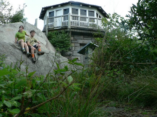
 La tour d'observation des feux a été construite par le CCC en 1939, de type "western" car construite en pierre contre la roche au lieu d'une tour de métal comme on voit souvent. La batisse s'abimait mais a été rénovée en 1995.
The lookout tower was built by the CCC in 1939, it's western style because built in rocks against the outcrop instead of the usual metal towers. The building was getting damaged but was renovated in 1995.

We enjoyed a bagel-cream cheese-tuna sandwich on the summit.

Here is the view of the tower from the trail.

The Mountains of the Great Smoky Mountains National Park.

On the way down we had quite a suprise, around the curve, just above the gap, we stopped dead in our tracks. 30-40 feet away from us was a bear cub in the middle of the trail. It looks at us for a few seconds before heading uphill. Usually my reflex would have been to pull out the camera, but here I have to admit y only thought was "where is the mother?". We did not see it, maybe she was napping. We did some noise just in case and continued our hike marveled by this brief vision.
The hike took us 5h40, including one hour for our break. The trailhead is at the back of the B loop of the Cosby campground. There are other trails to access it but we picked the Low Gap Trail and then the Appalachiant trail. The articulations worked well on the way down and we had sore muscles for two days.

Magnifique rando ! Ce papillon, cette vue... Ca donne envie :)
RépondreSupprimer@Londoncam: Ça fait peut être un peu trop de route et de marche pour votre visite, mais ne t’inquiète pas. Grandfather Mountain vaut aussi sacrement le détour (pour moins de marche en plus). J'essaye de convaincre Hubby de prendre le lundi de repos pour y aller avec nous.
RépondreSupprimer