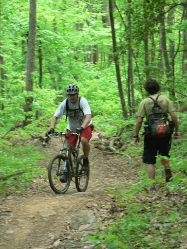
Nous n'avons rencontres aucun randonneur, mais par contre nous n'étions pas tout seul car les VTT eux par contre s'y donnent a cœur joie.
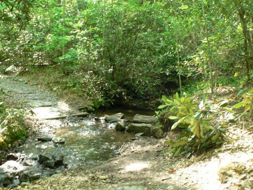
Ten days ago, at the last minute, we decided to go on a hike.Since it was after 3pm we didn't go far, just to Brent Creek about 10 miles away from the house. Around Lake Powhatan there are many trails well used by the people of Asheville. The area is known as Bent Creek, a section of the Pisgah National Forest used as an experimental forest.
We didn't meet any hikers, however we were not alone as mountain bikers were having blast there.
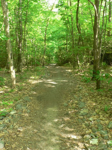
Le sentier est pour la plupart a l'ombre des arbres, fort agréable vu les températures auxquelles nous avons droit ce printemps.
The trail is mostly in the trees shade, quite pleasant given the temperatures we're getting this spring.
 A cette intersection nous avons eu une petite frayeurs, en effet nous avons entendu des VTT qui dévalaient le sentier. On a fait ni une ni deux et on c'est mis hors sentier pour les laisser passer. En fait nous ne risquions rien, ils étaient sur le sentier juste au dessus de nous, mais bon mieux vaut avoir de bon réflexes.
At this intersection we had a scare, indeed we heard mountain bikes coming down fast on the trail. We didn't wait to think and moved out of the way to let them through. But the truth is we weren't in any danger as they were on the trail right above us, but it's better to have good reflex in any case.
 Au col d'Ingles Field il y a du travail en cours, une nouvelle route forestière on dirait.
At Ingles Field Gap there is ongoing work, a new forest road it seems.
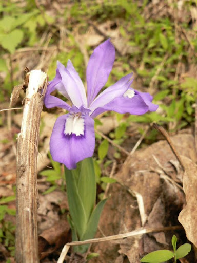
 Nous avons pu admirer la faune comme les Sceaux de Salomon,
We were able to admire the flora such as Salomon's Seals,
 et Iris sauvages.
and wild Irises.
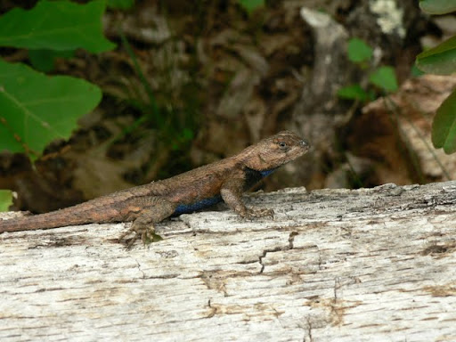
 Et la faune avec un lézard.
And fauna with a lizard.
 Avant de laisser passer un énième vététiste.
Before letting through yet an other mountain biker.
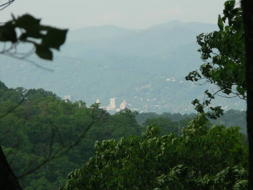
 A un moment la vue c'est ouverte et nous avons pu apercevoir quelques immeubles du centre ville, le bâtiment de BB&T, le palais de justice et la mairie.
At one point the view opened up and we were able to catch a glimpse of the downtown buildings, the B&T building, the courthouse and the town-hall.
 Une ballade franchement pas difficile, bien agréable au milieu de la foret. Bien pour un peu d'exercice en fin de journée. Par contre il faut garder les oreilles ouvertes pour les VTT. D'ailleurs ca nous a donne bien envie d'en avoir.
A hike fairly easy, pleasant in the middle of the forest. Good for a little exercise at the end of the day. However it's important to keep the ears open for the mountain bikes. In fact it made us want to buy some.
 Depuis Asheville, prendre la I-26E, sortie 33 (Blue Ridge Parkway) suivre la route 191 S en direction de Brevard. Tourner a droite sur Bent Creek Branch Rd peu avant le NC Arboretum puis la première a gauche Wesley Branch Rd jusqu'à l'entrée du camping, continuera droite sur la route forestière. Continuer plusieurs miles il y a un espace pour se garer sur la droite qui permet de rejoindre le sentier ou continuer jusqu'à l'intersection pour plus de parking.
Suivre le sentier de Boyd Branch (665), puis prendre a droite sur Sidehill Connector (145), prendre a gauche sur Ingles Field Gap (150) puis suivre Little Hickory Gap (136)sur la crête, a l'intersection suivante prendre le chemin de gauche, Sidehill Connector qui rejoint Boyd Branch.
From Asheville, take I-26E, exit 33 (Blue Ridge Parkway) follow road 191 S direction Brevard. Take a right on Bent Creek Branch Rd shortly before the NC Arboretum then take the first left onto Wesley Branch Rd until the entrance of the campsite, there take a right and continue on the forest road. A few miles down there is space to park on the right and a path leading to the trail or continue to the interesection for more parking.
Follow Boyd Branch trail (665), then take a right on Sidehill Connector (145), take a let on Ingles Field Gap (150) then follow Little Hickory Gap at the crest, at the next intersection take the left trail, Sidehill Connector that will connect back with Boyd Branch.

Ca me dit bien comme balade !!
RépondreSupprimer@Londoncam: A ajouter a la liste des potentiels pour Septembre?
RépondreSupprimerPour la vue sur Asheville Month Pisgah, 1h de montee vaut aussi franchement le coup.